About Special Areas
The Special Areas Board was set up under the Special Areas Act in response to the extreme hardship of the depression in the 1930s. This region was first populated by settlers who braved the weather and harsh living conditions to carve out lives for themselves.
Covering over 5 million acres, Alberta’s Special Areas are in southeastern Alberta, with boundaries stretching from Dorothy in the west to the Saskatchewan border in the east. This vast region reaches up to Consort in the north, while the southern region extends south of the Red Deer River to the Suffield Base. Additionally, a section of the South Saskatchewan River frames the southeast corner of the Special Areas. The Special Areas is one of the largest rural municipalities in the Province of Alberta and provides services to 32 hamlets in the region.
The Special Areas is responsible for managing public lands and providing municipal services to the region. Over 2.5 million acres of public lands are managed by the Special Areas Board including grazing lands, community pastures, and limited cultivation. Since 1938, the Special Areas has been committed to the balanced stewardship of public lands while supporting responsible agricultural and industrial use within the Special Areas. Providing municipal services to over 4000 residents, the Special Areas Board continues to build on regional partnerships to efficiently provide municipal services, recreation opportunities, and economic development.
The Special Areas Board is an agency of the Government of Alberta (sometimes called a crown agency). The four-member board is appointed by the Lieutenant Governor and includes three members recommended from the locally elected thirteen-member Advisory Council.
This unique form of municipal government was created in the 1930s under the Special Areas Act after widespread rapid depopulation from the Great Depression bankrupted more than 36 municipalities in the region. The Special Areas Board was created to help stabilize the region and provide services to the people who remained in the region.
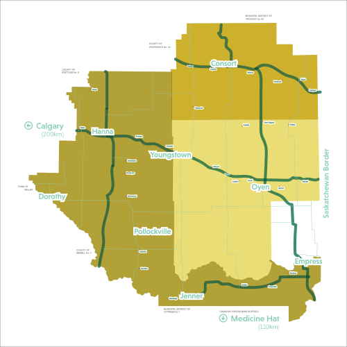
Covering over 5 million acres, Alberta’s Special Areas are in southeastern Alberta, with boundaries stretching from Dorothy in the west to the Saskatchewan border in the east. This vast region reaches up to Consort in the north, while the southern region extends south of the Red Deer River to the Suffield Base. Additionally, a section of the South Saskatchewan River frames the southeast corner of the Special Areas. The Special Areas is one of the largest rural municipalities in the Province of Alberta and provides services to 32 hamlets in the region.
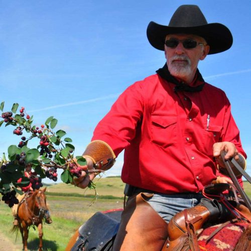
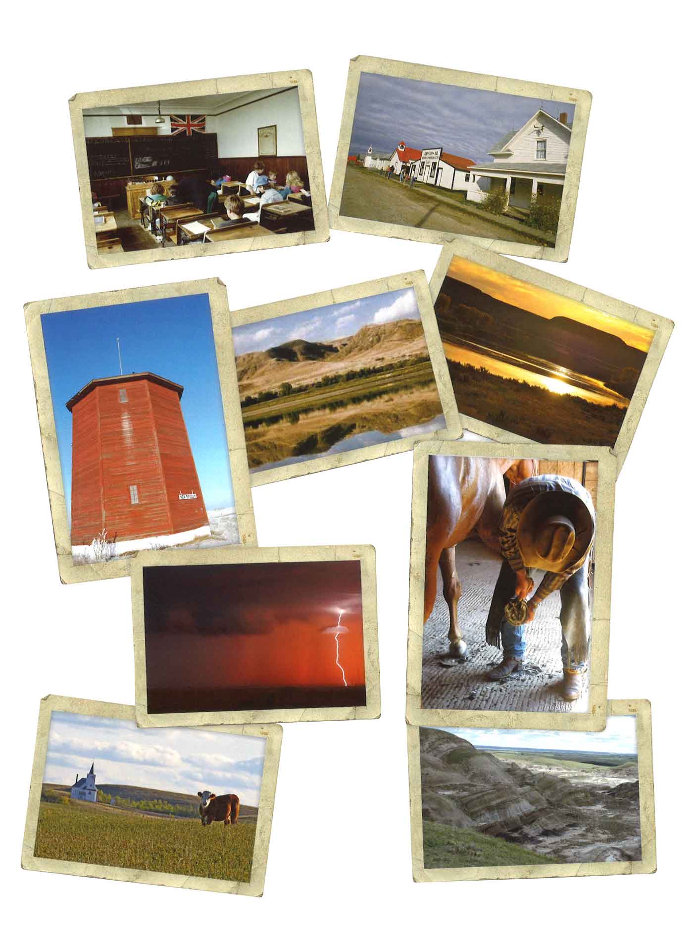
The past meets the present in the Special Areas. All experiences are unique and unforgettable.
Take a scenic ride into the forgotten plains of Alberta, filled with miles upon miles of farmland and little towns. Relax and enjoy the horizon that seemingly goes on for days, while taking in layers and layers of history – forgotten and sealed under cobwebs, rust and golden wheat fields.
What is the history of the Special Areas?
First some early history. The Palliser Expedition took place from 1857-1860.
The Special Areas is in the Palliser Triangle, an expanse of semi-arid land in Southeast Alberta and Southwest Saskatchewan. It was considered a land that had no potential for farming which would not sustain human life. This area, over five million acres of barren prairie, would eventually be known as the Special Areas.
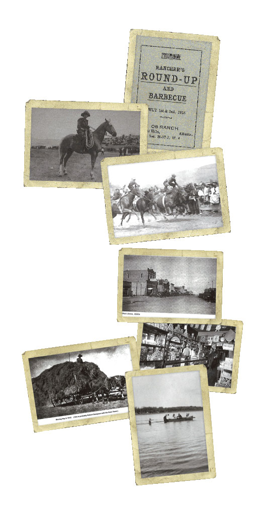
The nomadic Indian bands roamed this area for centuries, followed by the fur traders and then the ranchers and cattlemen. The arrival of the railroad in the 1880’s introduced grain and cereal farming to the area and the drive to settle Canada’s west before the Americans would win it by default. The area opened for homesteading January 1st, 1909, driving out the cattleman as the grassy feeding areas were being claimed by farmers and planted. Some early ranchers had herds of 3,000 up to 12,000 head. The winter of 1906-07 was a hard one. Some rancher’s accounts have the average temperature of 42 below zero, with a low temperature of 62 below zero. Most of the big cattle herds were wiped out.
Not until 1909 and 1910 did the large numbers of immigrants arrive on the prairies. Under the Dominion Act, “the only cost of a farm for a man who came to settle would be his sweat, his time and his courage apart from the token costs of filing,” (Gorman, pg. 13) Should he settle the land, by breaking 30 acres and planting a crop on at least 20 acres within 3 years after paying a $ 10 filing fee, he would win the deed. (pg. 20, Gorman)
In 1901, there were only 75 residents in what would later be called the Special Areas. In 1911, the number had jumped to 13,170 and by 1916, 24,164 with the peak of the population reached in 1921 at 29,689. The rapid increase in settlers demanded services such as roads, hospitals, and school districts. Municipal districts were consequently developed. These were small without a diverse economic base to remain sustainable.
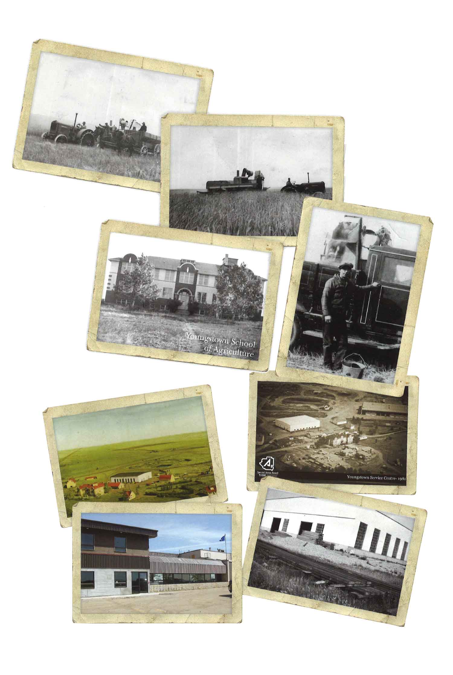
1910 was the promise of roads and railroads and the Canadian Pacific Railway and the Canadian National Railway. By 1912 a line from Saskatoon to Calgary was under construction and reached Youngstown by 1912 and Munson in 1913. By 1915, the CNR built a line south from Hanna to Medicine Hat. Grain was moved by rail but eventually grain elevators were built to store the grain. Wheat was king and farmers were now flourishing.
The Special Areas presented endless opportunities to move forward during its early years including thousands of kilometers of needed roads, fences, land to administer, soil to amend and progressive thinkers to get the region developed to where it is today. This five-million-acre land base is known today as the Special Areas
In the 1930s, recurring droughts hit the Special Areas. The average wheat yield went from 34.8 bushels per acre in 1927 to 1.1 bushels per acre in 1931. This was due in part to the poor farming practices common for the day. Sandy soils were the easiest to plow, but these practices depleted soil nutrients.
By the summer of 1931, eight years of drought resulted in an exodus or many farmers or those that were looking for some relief. By 1932, A Report of the Dry Areas of Alberta and Crop Insurance was commissioned by Provincial Agricultural Minister W.N. Chant. He commissioned University of Alberta student, Donald Cameron, M.Sc. to report on the conditions of the area. Farmers hoped this might generate some relief or bring recommendations to their dilemma. The report concluded that the farmers was broke, the mortgage companies were broke, and the school districts were disorganized. The district was covered with 19 different municipal districts, all of which did not have the tax base to sustain their own areas. This Berry Creek Report was read to the Government House, and it was agreed that legislation be brought in based on this report under the name The Special Municipal Areas Act – a policy to control the population and the use of land. Twenty-five recommendations were attached that would become the regulatory framework for the Special Areas. A general plan would be developed for the reorganization of the area.
The recommendations of the Tilley East Commission laid the groundwork for the Special Areas Act of 1938, followed by Berry Creek.
Berry Creek district was firstly developed and declared a closed area that no further lands be alienated from the Crown. Authority was given to proper administrators to settle arrears of taxes, seed grain relief and other Crown claims against the land or cancel any Crown lien against it entirely. A representative board was now implemented to make these decisions and the task of rearranging settlers to new locations within or outside the area. They further had the task of determining which lands should now revert to grazing lands to enhance cattle growth and avoid severe grain shortages in areas prone to drought conditions. Consideration was given to present residents who desired to remain and could satisfactorily use the land and that every possible assistance be given regarding their liabilities. A complete restructuring and repurposing of the area was taking place. Any settlers wishing to move out of the area would receive free freight and would surrender title to the Province of Alberta of all land and their possessions. As settlers left, new settlers were limited with a plan to rebuild the area to meet the needs of a reduced population more appropriately.
The Special Areas administration is not the product of a grand design. It was rather the result of an evolutionary process which began restructuring and consolidating the various institutions mainly municipalities and school districts. It instituted relief programs and began working with relocation and rehabilitation for the settlers of East Central Alberta. (Gorman, Land Reclaimed, 1988, pg. 123)
Along with the new structuring came those that wanted to purchase the abandoned leases. Priority was given to the settlers over the newcomers. Despite the best efforts, the areas were still deteriorating with soaring temperatures of a recorded high of 48.9 C, recorded on August 7, 1932, and grasshoppers stripping everything.
The administration office was moved to Hanna, allowing them to work more closely with farmers and ranchers to improve the drought-stricken region. (Travel Special Areas, 75 Years Publication, pg. 8.) Farmers had the option to switch out their land for more prosperous land and were also encouraged to turn their grain fields back into grazing for cattle.
As more municipalities suffered drought, low prices and disorganization, Special Areas continued to grow. A total of 37 municipal districts were now reorganized into six Special Areas. These areas were now under uniform legislation and under the authority of a single board of three members.
The Special Areas Board was set up under the Special Areas Act in response to the extreme hardship of the depression in the 1930s.
The Special Areas Board is an agency of the Government of Alberta (sometimes called a crown agency). The four-member board is appointed by the Lieutenant Governor and includes three members recommended from the locally elected thirteen-member Advisory Council.
The Special Areas is responsible for managing public lands and providing municipal services to the region. Over 2.5 million acres of public lands are managed by the Special Areas Board including grazing lands, community pastures, and limited cultivation. Since 1938, the Special Areas has been committed to the balanced stewardship of public lands while supporting responsible agricultural and industrial use within the Special Areas. Providing municipal services to over 4000 residents, the Special Areas Board continues to build on regional partnerships to efficiently provide municipal services, recreation opportunities, and economic development.
Even after the years of despair, some farmers stayed and became some of the best farmers in Alberta. Re-grassing, new techniques from agricultural departments, new technology, and machines have changed the face of the area. Special Areas was healthier on a per operator basis than any other area of Alberta, including the best land around Red Deer.
Based on A Land Reclaimed by Jack Gorman, 1988
Present Day
So that brings us back to today. With a population of over 4 thousand people, and over 5 million acres under the administration of the Special Areas Board, the current Special Areas Board is broken into 3 Special Areas – 2, 3 and 4.
Which begs the question, what happened to Special Area Number 1?
Prior to 1938 there were six special districts designated Neutral Hills, Sounding Creek, Sullivan Lake, Berry Creek, Tilley East and Bow West. In 1941 Tilley East, was the poorest and least populated, was removed and became the Suffield Block and part of the improvement district. When Tilley East was removed, Sullivan Lake, Berry Creek and the portion south of the Red Deer River became Special Area No. 2. Sounding Creek and Neutral Hills became Special Area No. 3. Bow West or Special Area No. 1 was removed in 1954 and became the County of Vulcan No. 2. In 1970, Special Area No. 3 was divided into Special Area No.’s 3 and 4. This change was simply the formal recognition of an administrative structure that saw an office in Consort function the same as the office in Oyen.